
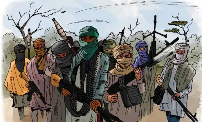
Panic As Terrorists Attack Kwara Communities, Abduct Residents
Suspected terrorists on Thursday night launched coordinated attacks on several communities in Isin and Ifelodun Local Government Areas of Kwara State, abducting...

Kwara State, known as the “State of Harmony,” is a culturally diverse state serving as a bridge between Northern and Southern Nigeria. With a rich history of Islamic and Yoruba traditions, Kwara is a major center for agriculture and education. Naija News provides real-time updates on Kwara’s economy, governance, and communal developments.
Quick Facts & Profile
| Category | Details |
| Current Governor | AbdulRahman AbdulRazaq (APC) |
| Capital | Ilorin |
| Founded | May 27, 1967 |
| Slogan | State of Harmony |
| Geopolitical Zone | North Central |
| Area | 36,825 km² |
| Population | ~3.5 Million+ (Estimated) |
| ISO Code | NG-KW |
Geography and Borders
Kwara is located in the North-Central region. It shares an international border with the Benin Republic to the west. Domestically, it is bordered by Niger State to the north, Kogi State to the east, and Ondo, Ekiti, and Osun States to the south.
Governance: From 1967 to Date
Kwara is one of Nigeria’s oldest states and has seen a transition from military rule to a long period of civilian influence:
Education and Landmarks
The state is home to the University of Ilorin (UNILORIN) and Kwara State University (KWASU). Notable landmarks include the Owu Waterfalls (one of the highest in West Africa) and the Esie Museum, the first museum in Nigeria.
Suspected terrorists on Thursday night launched coordinated attacks on several communities in Isin and Ifelodun Local Government Areas of Kwara State, abducting...

Security forces have reportedly ambushed a notorious bandit kingpin, Ibrahim Bastuji, and his fighters while they were allegedly planning to attack a...

The crisis rocking the Peoples Democratic Party (PDP) in Kwara State has deepened after one of its governorship candidates, Hassan Oladimeji, announced...
Troops of the Nigerian Army under the Joint Task Force North Central, Operation Savannah Shield, have rescued two kidnap victims during a...
Five worshippers abducted during an attack on an Evangelical Church Winning All (ECWA) congregation in Omugo, Oro Ago District of Ifelodun Local...

A source within the Emir’s palace in Yashikira, Baruten Local Government Area of Kwara State, has alleged that police officers abandoned their...
A palace source in Yashikira Emirate, Baruten Local Government Area of Kwara State, has alleged that terrorists used a diversionary threat against...
Members of the Nigeria Union of Teachers (NUT), Kwara State wing, on Tuesday (today) joined the nationwide solidarity rally organised by the...

A leadership crisis has hit the Peoples Democratic Party (PDP) in Kwara State following the emergence of two factional governorship candidates ahead...
Families of victims abducted from the Woro community in the Kaiama Local Government Area of Kwara State have said suspected Boko Haram...
Fresh fear has gripped the Yashikira community in Kaiama Local Government Area of Kwara State after terrorists who abducted some wives of...
A renowned Islamic scholar has been killed by unidentified assailants in Baruten Local Government Area of Kwara State. Security sources told Zagagola...

Boundaries linking Ekiti State with Kogi and Kwara states have been identified as major flashpoints posing security threats to communities in the...
Popular Islamic cleric, Sheikh Abdulqodir Kamaludeen Al-Adaby, is dead. Naija News reports that the Kwara-born cleric died in Ilorin on Friday at the...

Pastor Adesoji Dada Aderemi of Divine Evangelical Mission Church, Woro community in Kwara State, has narrated how terrorists attacked his church during...

Some worshippers and residents at the Ilorin Central Eid praying ground on Wednesday broke into anti-government chants against the All Progressives Congress...
The Kwara State Command of the Nigeria Police Force has confirmed an attack by suspected bandits on the Yashikira Police Divisional Headquarters...
Suspected armed bandits have attacked a remote prayer ground in the Ekiti Local Government Area of Kwara State, killing at least three...
The Peoples Democratic Party (PDP) has announced Engineer Kale Kawu as its consensus gubernatorial candidate for the 2027 election. This was announced...
The Speaker of the Kwara State House of Assembly, Saliu Danladi, has emerged as the winner of the All Progressives Congress (APC)...
